-
Geospatial Survey: A Client’s Dream
The past few years have brought a variety of powerful Hi-Definition Scanning (HDS) technologies to the survey industry that have added an entirely new dimension to the way we acquire survey data and produce deliverables for our clients. Maser Consulting has assembled a Geospatial Dream Team of experts who have become entrenched in the advancements of this equipment and technology, ... Read More
-
Environmental Update with Bob Zelley, PG, LSRP
GUIDANCE FOR CONTAMINATED SITE OWNERS The purpose of this entry is to provide regulatory guidance for a Responsible Party of a contaminated site located in New Jersey. The following describes the requirements for project oversight and the retention of a Licensed Site Remediation Professional (LSRP) as required by the NJ Department of Environmental Protection (NJDEP). According ... Read More
-
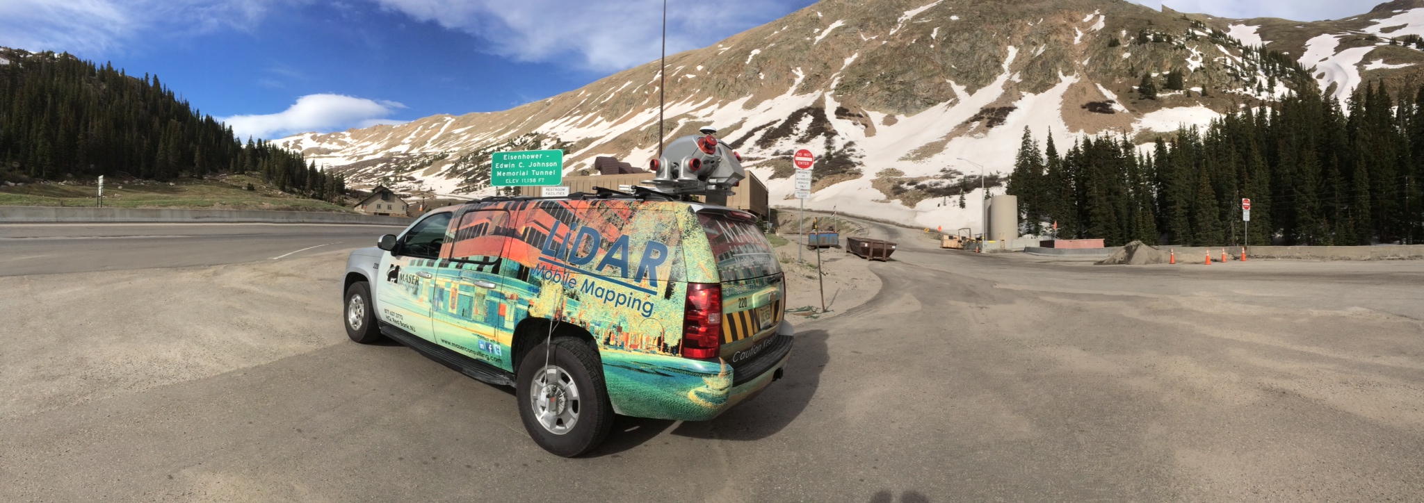
Where’s Wygant?
GEOSPATIAL MAN-ON-THE-MOVE LiDAR Mac. Maser Consulting, in conjunction with Radar Awning in Albuquerque, manufacturer of fine awnings and coverings, has developed the RiCover. This unique environmental cover can be affixed to the RIEGL VMX 450 scanner within moments of changing weather conditions. Because of its of durable weather-resistant construction and ease of use (in accordance ... Read More
-
Mobile Mapping for Engineering Design
REPRINTED WITH PERMISSION BY SPAR July 30, 2014 || Mobile mapping systems (MMS) offer many benefits when acquiring very accurate and precise field survey data. One of the biggest benefits offered by mobile mapping is the drastic reduction in exposure of survey field crews to the hazards of a project site and any live traffic ... Read More
-
Where’s Wygant?
GEOSPATIAL MAN-ON-THE-MOVE Welcome to the Land of Enchantment. But just because Wygant’s truck is here doesn’t mean that he is. Maser Consulting recently announced the opening of its newest office in Albuquerque, New Mexico. We’re re-announcing now it because it is currently being anchored by mobile LiDAR services—Wygant’s favorite thing. The firm is in the ... Read More
-
Where’s Wygant?
GEOSPATIAL MAN-ON-THE-MOVE Clay Wygant. Mobile Mapping Extraordinaire. Take a good look at his picture because scanning a million points per second makes Wygant so fast you may never catch up with him! LiDAR. Light Detection and Ranging. The same technology that helps cops catch speeders, is now being used to collect mega survey data for terrain, ... Read More

WE ARE COMMUNICATORS
... sharing information and insights.