
Baltimore and Potomac Tunnel Mapping
City of Baltimore, Baltimore County, MD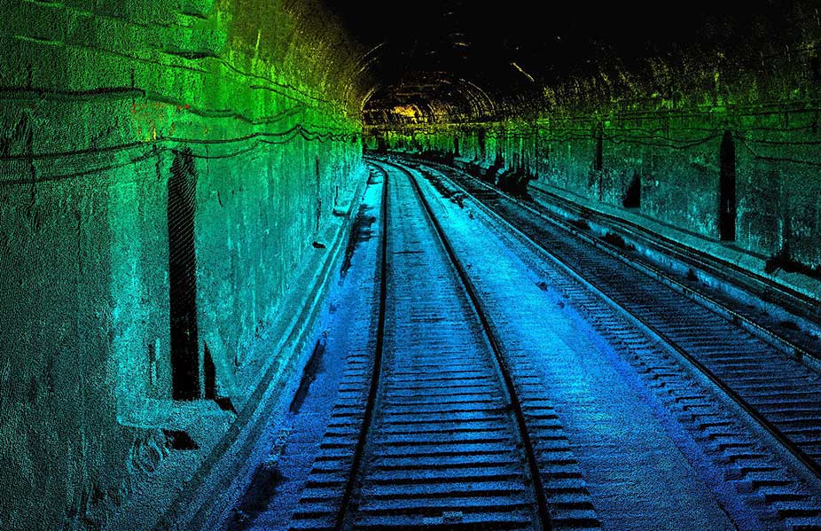
Baltimore and Potomac Tunnel Mapping
City of Baltimore, Baltimore County, MD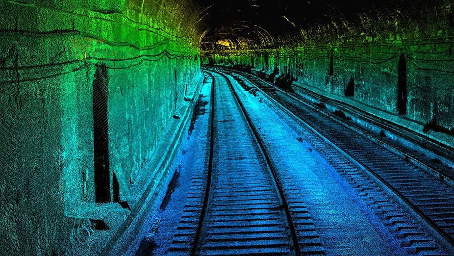
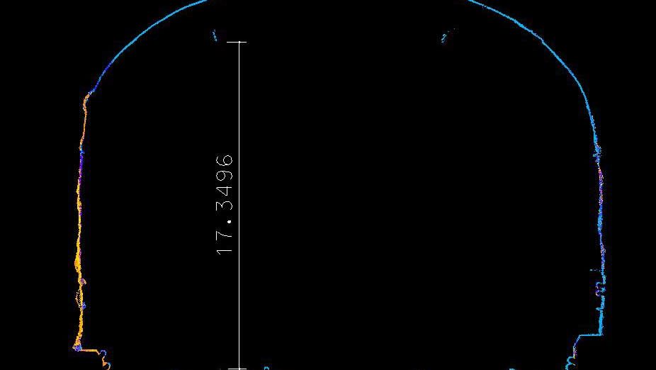
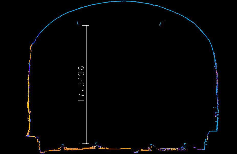
Provided Mobile LiDAR mapping services for the Baltimore and Potomac tunnels along Amtrak’s busy northeast corridor. The tunnels that run under the city of Baltimore, Maryland, were being inspected and repaired on a typical maintenance cycle. Using the Mobile LiDAR system along the 7,700 feet of existing rail expedited the collection of a full 3D scanned point cloud of the current condition of the tunnels.
This operation allowed the Amtrak team to review the data from an office environment and kept personnel off the tracks and out of harm’s way. The scanning took a single overnight window to complete and did not interrupt revenue service for the agency.
SERVICES
- Land Survey
- LiDAR Mobile Mapping
- Rail & Tunnel