
PennDOT Sign Inventory & Geodatabase Modeling
Montgomery County, PA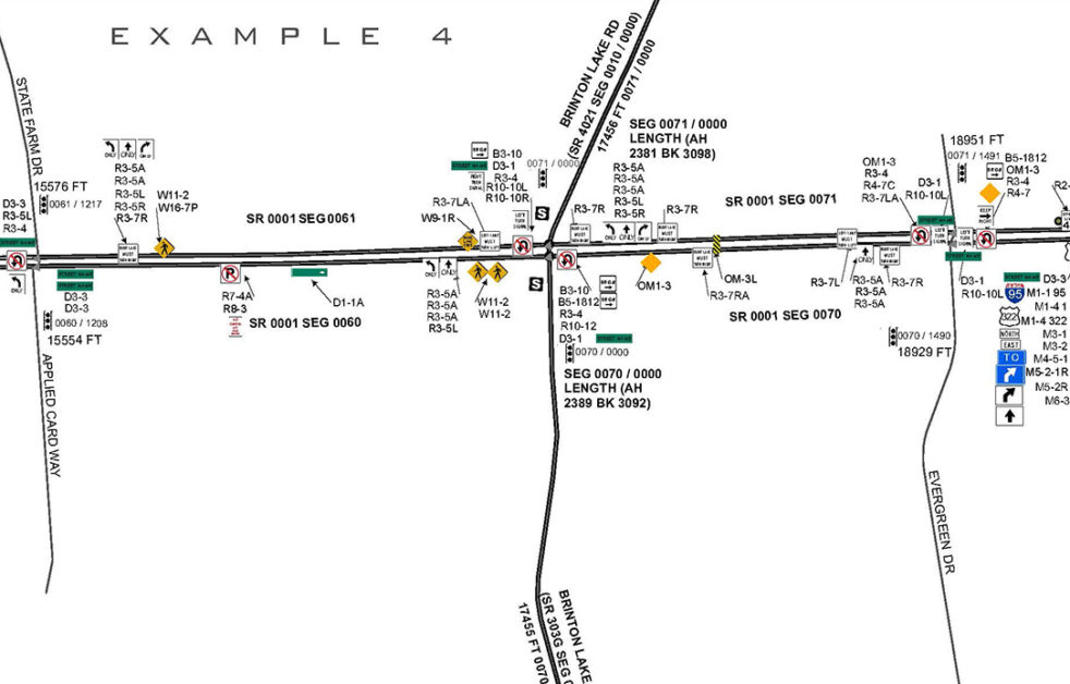
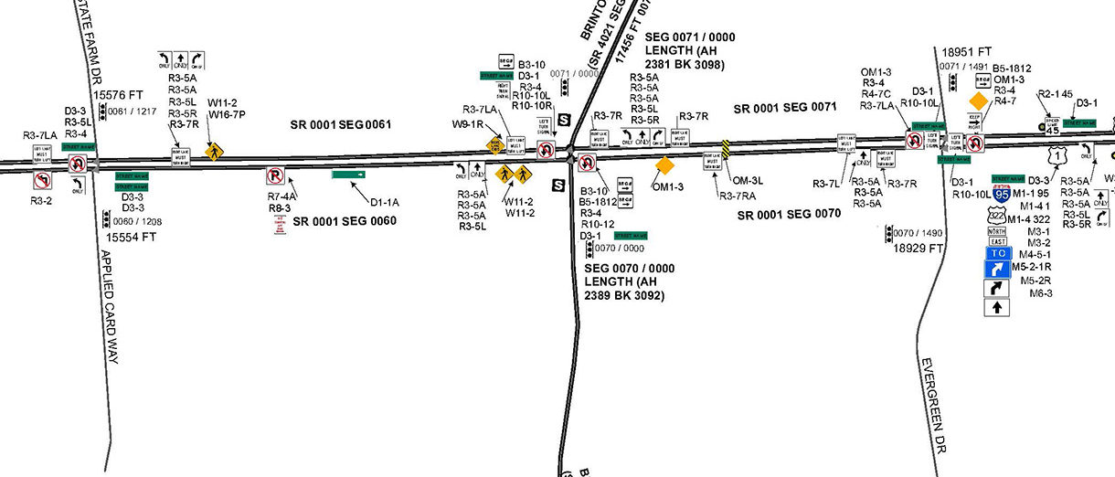
Provided mobile LiDAR mapping and GIS mapping services along 100 miles of PennDOT District 6 roadways for a sign inventory and transportation collection. From the data collected, a geodatabase model was created to manage the roadway surface features by mapping out curbing, medians, lanes, roadway shoulders, and pavement markings. The geodatabase also included curve advisory inspection data, matching curves to existing speed limit signage. The signs were catalogued by MUTCD code and condition attributing.
The data will be used to manage the maintenance of PennDOT District 6’s route network. Project data was delivered in ESRI geodatabase format for signs, pavement markings, roadway geometry, straight line diagrams, and corresponding design level Microstation basemaps, following PennDOT’s CAD standards.
SERVICES
- GIS
- LiDAR Mobile Mapping