
UAS Violation Detection & GIS Web Map Dashboard
Bethlehem City, Lehigh County, PA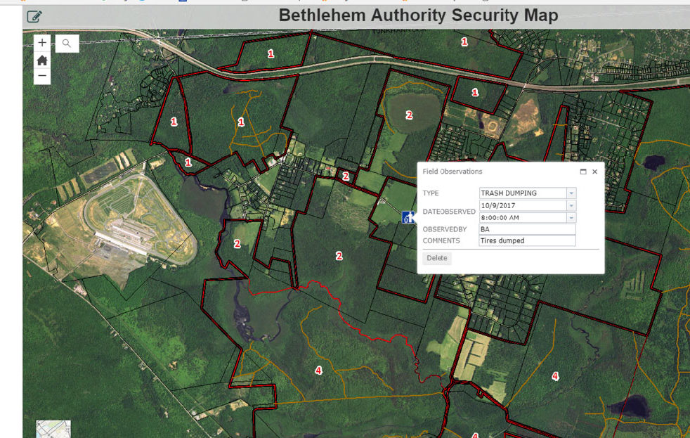
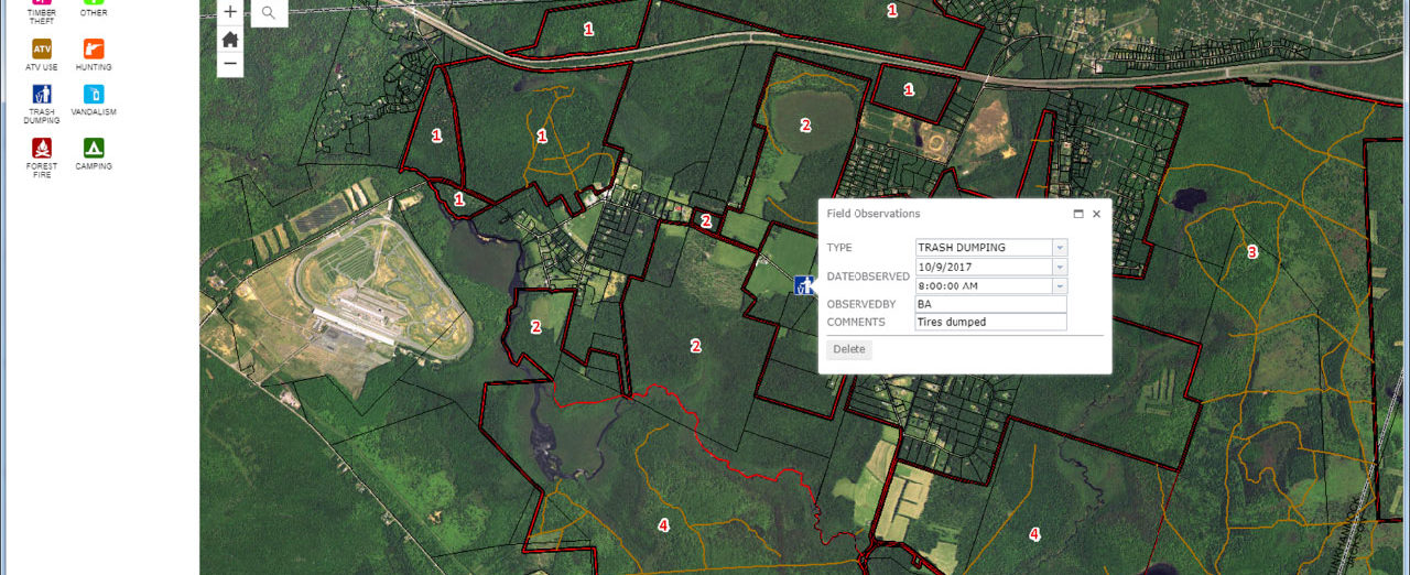
Bethlehem Authority maintains 26,000 acres of watershed that services the Lehigh Valley of Pennsylvania. There have been many incidents of trespassers and ATV riders on the property that have caused deforestation and wildfires, among other problems. Colliers Engineering & Design was contracted to introduce the Authority to an in-house unmanned aerial system (UAS) program to manage trespassers by providing a GIS web dashboard that consumes drone data and boots on the ground investigation data. The GIS program, coupled with the drone initiative, has given the Authority the tools to support incarceration of trespassers to its property.
The online GIS program allows the Authority directors a real-time view of incidents that support corrective action to maintain the pristine environments for which they are responsible. The image above demonstrates the GIS web program that is currently being used by the Authority. At the completion of the UAS and GIS program implementation, training of staff and standard operation procedures were handed over to the Authority. We continue to support our client with new technology and onboard training for new employees.
SERVICES
- GIS
- Unmanned Aerial Systems Survey